World Timezones — free printable diagram
Free geography resource for teachers · CC BY-NC 4.0
About this illustration
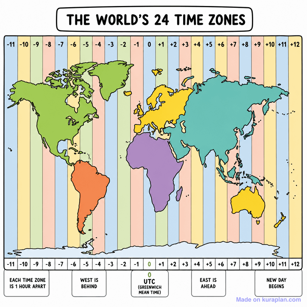
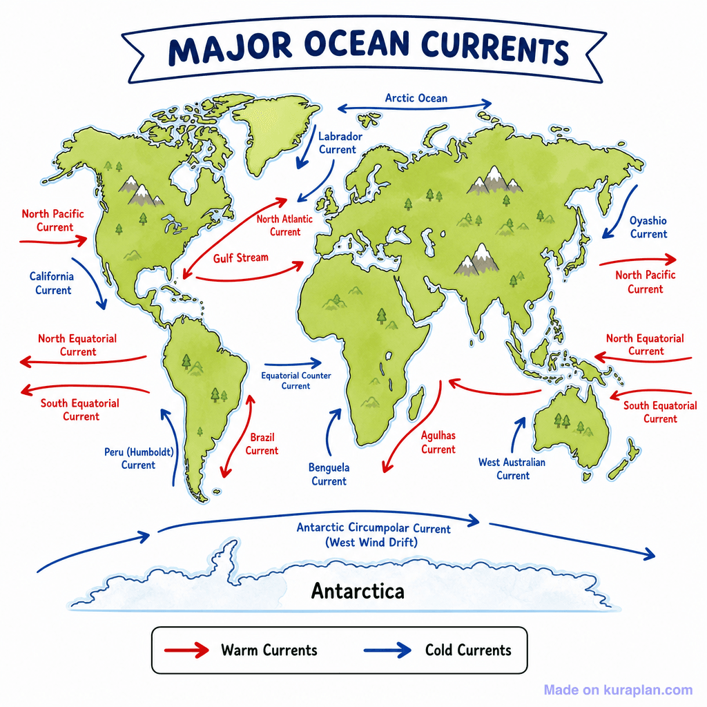
This image displays a flat-style world map clearly illustrating the Earth's 24 time zones. Continents are depicted in distinct colors (green, orange, purple, yellow, teal), overlaid with vertical pastel-colored stripes representing each time zone, numbered from -11 to +12. The central '0' zone is identified as UTC (Greenwich Mean Time), with explanatory text boxes at the bottom detailing time relationships (e.g., "WEST IS BEHIND", "EAST IS AHEAD", "NEW DAY BEGINS"). This educational diagram teaches fundamental geography and the concept of global time differences. It is suitable for classroom slides, worksheets, or as a reference chart for calculating time. The visual style is a clean, flat illustration with clear labels.
How to use
- 1Right-click the image and choose “Save image as”, or use the download button.
- 2Use it in your classroom worksheets, slides or printables — free under CC BY-NC 4.0.
- 3Attribute as “Image by Kuraplan” or link back to kuraplan.com. Not for commercial resale.
Make worksheets with images like this
Kuraplan's editor has the full image library built in — drag-and-drop into a worksheet in seconds.
Related illustrations
More from World Maps (Thematic)
Browse by subject
18 subjects · 5,159 free illustrations

Maths
1,912 free illustrations
Cross-Curricular
839 free illustrations

Science
818 free illustrations

English
625 free illustrations

Health
201 free illustrations
social_studies
178 free illustrations

Religious Education
140 free illustrations
Music
130 free illustrations

Art
66 free illustrations

Drama
56 free illustrations

social_sciences
48 free illustrations

History
47 free illustrations

arts
26 free illustrations

pe
25 free illustrations

te_reo_maori
24 free illustrations

tech
16 free illustrations

culture
7 free illustrations

languages
1 free illustrations