World Ocean Currents — free printable diagram
Free geography resource for teachers · CC BY-NC 4.0
About this illustration
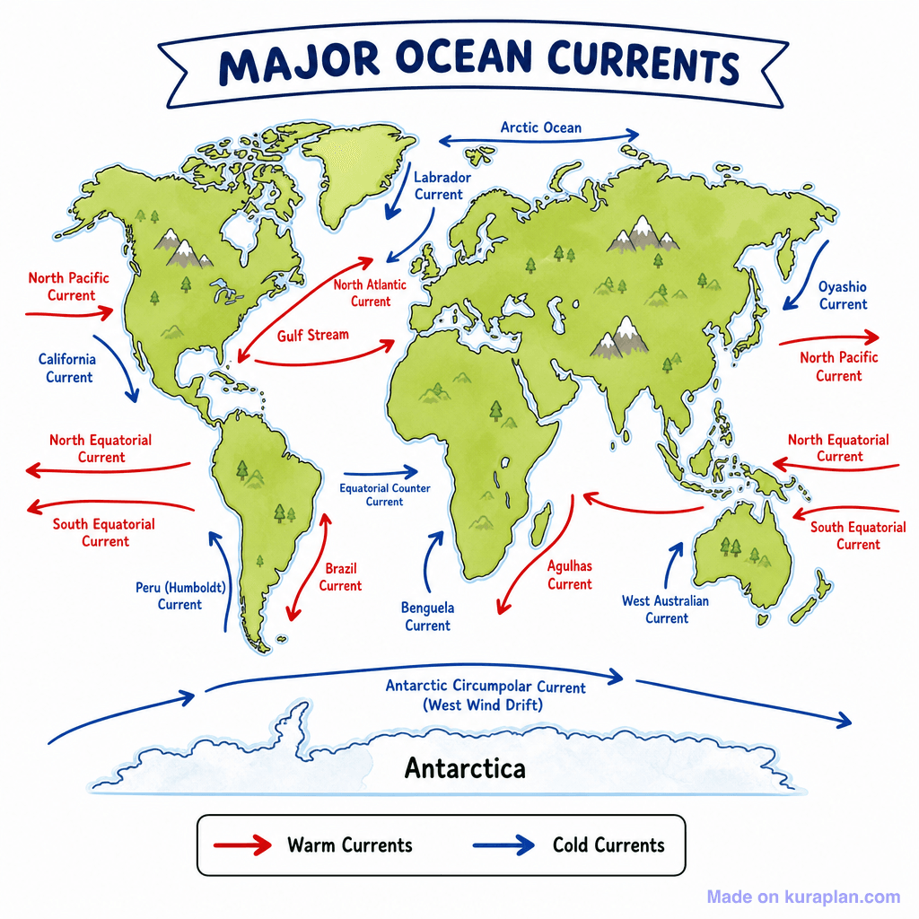
This image is a flat illustration of a world map depicting the major ocean currents. Continents are shown in green with simple trees and mountains, while the oceans are blue, illustrating the global distribution of currents. Red arrows indicate warm currents, such as the Gulf Stream and Brazil Current, while blue arrows represent cold currents like the Labrador and Benguela Currents, as clarified by a legend. The map is clearly labeled with the names of over twenty different currents and includes a title, making it ideal for classroom slides or reference sheets for geography and earth science lessons. It can be used for activities exploring global climate patterns or marine ecosystems.
How to use
- 1Right-click the image and choose “Save image as”, or use the download button.
- 2Use it in your classroom worksheets, slides or printables — free under CC BY-NC 4.0.
- 3Attribute as “Image by Kuraplan” or link back to kuraplan.com. Not for commercial resale.
Make worksheets with images like this
Kuraplan's editor has the full image library built in — drag-and-drop into a worksheet in seconds.
Related illustrations
More from World Maps (Thematic)
Browse by subject
18 subjects · 5,159 free illustrations

Maths
1,912 free illustrations
Cross-Curricular
839 free illustrations

Science
818 free illustrations

English
625 free illustrations

Health
201 free illustrations
social_studies
178 free illustrations

Religious Education
140 free illustrations
Music
130 free illustrations

Art
66 free illustrations

Drama
56 free illustrations

social_sciences
48 free illustrations

History
47 free illustrations

arts
26 free illustrations

pe
25 free illustrations

te_reo_maori
24 free illustrations

tech
16 free illustrations

culture
7 free illustrations

languages
1 free illustrations