Uk Four Countries — free printable diagram
Free geography resource for teachers · CC BY-NC 4.0
About this illustration
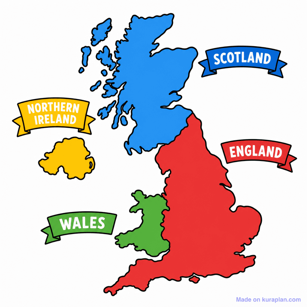
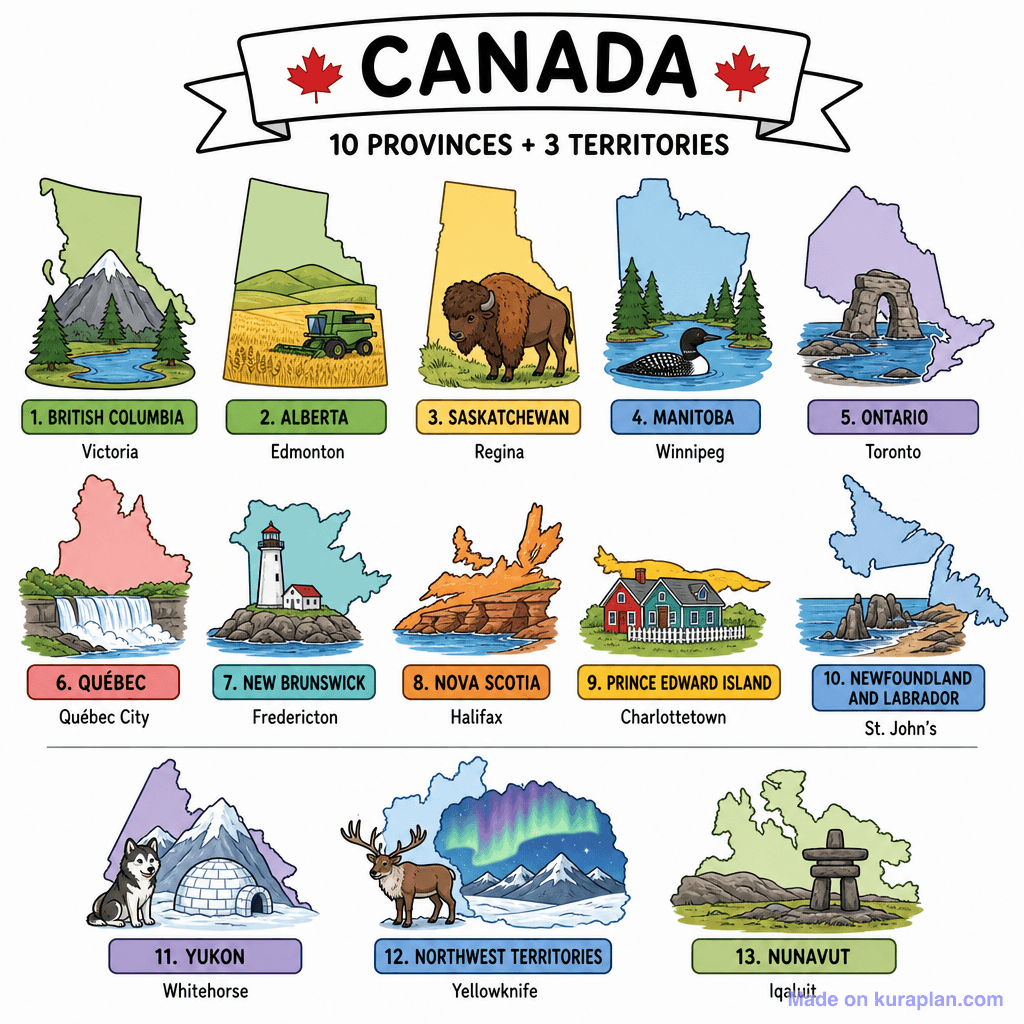
This image presents a simplified, colorful map of the United Kingdom, clearly outlining its four constituent countries. England is depicted in red, Scotland in blue, Wales in green, and Northern Ireland in yellow, each with a corresponding labeled banner. It is designed to teach students about the geography and political divisions of the UK. This flat illustration is suitable for classroom activities such as worksheets, slide presentations, or labeling exercises in a UK or European geography unit.
How to use
- 1Right-click the image and choose “Save image as”, or use the download button.
- 2Use it in your classroom worksheets, slides or printables — free under CC BY-NC 4.0.
- 3Attribute as “Image by Kuraplan” or link back to kuraplan.com. Not for commercial resale.
Make worksheets with images like this
Kuraplan's editor has the full image library built in — drag-and-drop into a worksheet in seconds.
Related illustrations
More from Regional / Political Subdivisions
Browse by subject
18 subjects · 5,159 free illustrations

Maths
1,912 free illustrations

Cross-Curricular
839 free illustrations

Science
818 free illustrations

English
625 free illustrations

Health
201 free illustrations
social_studies
178 free illustrations

Religious Education
140 free illustrations
Music
130 free illustrations

Art
66 free illustrations

Drama
56 free illustrations

social_sciences
48 free illustrations

History
47 free illustrations

arts
26 free illustrations

pe
25 free illustrations

te_reo_maori
24 free illustrations

tech
16 free illustrations

culture
7 free illustrations

languages
1 free illustrations