Uk Counties Ceremonial — free printable diagram
Free geography resource for teachers · CC BY-NC 4.0
About this illustration
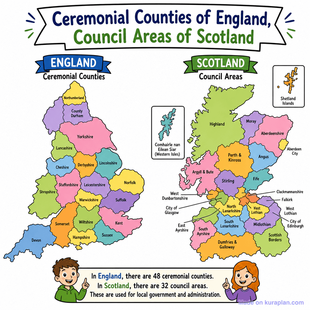
This vibrant, flat illustration displays two side-by-side political maps of the United Kingdom: England's ceremonial counties and Scotland's council areas. Each distinct region is brightly colored and clearly labelled with its name, including inset maps for island territories like Shetland and the Western Isles. Below the maps, two cartoon children point to a factual text box explaining the number of divisions (48 in England, 32 in Scotland) and their role in local government. This image is ideal for classroom slides or worksheets introducing UK geography and administrative divisions for K-12 students.
How to use
- 1Right-click the image and choose “Save image as”, or use the download button.
- 2Use it in your classroom worksheets, slides or printables — free under CC BY-NC 4.0.
- 3Attribute as “Image by Kuraplan” or link back to kuraplan.com. Not for commercial resale.
Make worksheets with images like this
Kuraplan's editor has the full image library built in — drag-and-drop into a worksheet in seconds.
Related illustrations
More from Regional / Political Subdivisions
Browse by subject
18 subjects · 5,127 free illustrations
Maths
1,900 free illustrations
Cross-Curricular
835 free illustrations
Science
816 free illustrations
English
615 free illustrations
Health
200 free illustrations
social_studies
177 free illustrations
Religious Education
139 free illustrations
Music
129 free illustrations
Art
66 free illustrations
Drama
56 free illustrations
social_sciences
48 free illustrations
History
47 free illustrations
arts
26 free illustrations
pe
25 free illustrations
te_reo_maori
24 free illustrations
tech
16 free illustrations
culture
7 free illustrations
languages
1 free illustrations