Trade Routes World Map — free printable diagram
Free geography resource for teachers · CC BY-NC 4.0
About this illustration
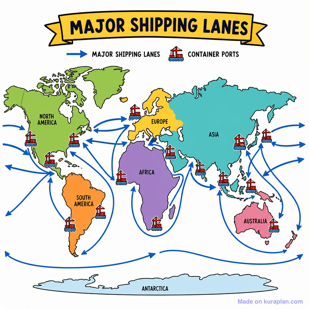
This image is a brightly colored, simplified world map illustrating major global shipping lanes and container ports. Continents such as North America, South America, Europe, Africa, Asia, and Australia are clearly labeled and depicted in different colors, with Antarctica shown at the bottom. Blue arrows crisscross the oceans, representing the flow of "Major Shipping Lanes", while red container ship icons mark key "Container Ports" along coastlines. It teaches about global geography, international trade, and the network of maritime transport that connects economies worldwide. This visual resource would be ideal for social studies or geography lessons, suitable for display on a slide or as part of a worksheet activity exploring globalization. The visual style is a flat, cartoon-style illustration with clear labels and high contrast.
How to use
- 1Right-click the image and choose “Save image as”, or use the download button.
- 2Use it in your classroom worksheets, slides or printables — free under CC BY-NC 4.0.
- 3Attribute as “Image by Kuraplan” or link back to kuraplan.com. Not for commercial resale.
Make worksheets with images like this
Kuraplan's editor has the full image library built in — drag-and-drop into a worksheet in seconds.
Related illustrations
More from Settlement & Urban

Browse by subject
18 subjects · 5,159 free illustrations

Maths
1,912 free illustrations
Cross-Curricular
839 free illustrations

Science
818 free illustrations

English
625 free illustrations

Health
201 free illustrations
social_studies
178 free illustrations

Religious Education
140 free illustrations
Music
130 free illustrations

Art
66 free illustrations

Drama
56 free illustrations

social_sciences
48 free illustrations

History
47 free illustrations

arts
26 free illustrations

pe
25 free illustrations
te_reo_maori
24 free illustrations
tech
16 free illustrations

culture
7 free illustrations

languages
1 free illustrations