Settlement Town Aerial — free printable diagram
Free geography resource for teachers · CC BY-NC 4.0
About this illustration
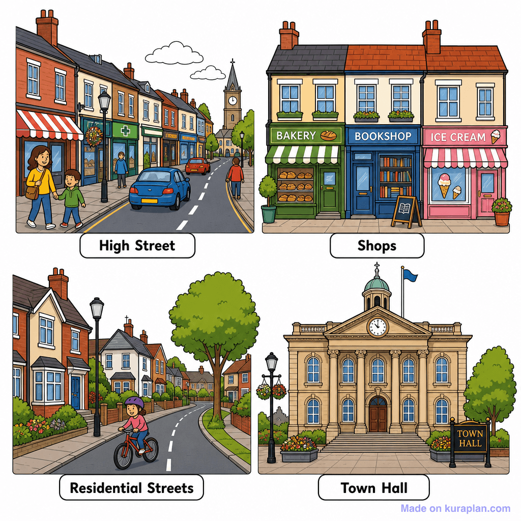
This image features four distinct, labelled panels, each illustrating a common area of a town or city. The top-left shows a "High Street" with various shops, pedestrians, and cars, leading to a distant church. The top-right panel details three specific "Shops": a Bakery, a Bookshop, and an Ice Cream parlour. The bottom-left depicts tranquil "Residential Streets" lined with houses and a child on a bicycle. Finally, the bottom-right presents a classical-style "Town Hall" building. This resource is ideal for teaching vocabulary related to community places and urban environments, suitable for social studies or geography lessons via worksheets or slide presentations. The visual style is a clear, flat, cartoon illustration with a strong UK or US town aesthetic.
How to use
- 1Right-click the image and choose “Save image as”, or use the download button.
- 2Use it in your classroom worksheets, slides or printables — free under CC BY-NC 4.0.
- 3Attribute as “Image by Kuraplan” or link back to kuraplan.com. Not for commercial resale.
Make worksheets with images like this
Kuraplan's editor has the full image library built in — drag-and-drop into a worksheet in seconds.
Related illustrations
More from Settlement & Urban


Browse by subject
18 subjects · 5,159 free illustrations

Maths
1,912 free illustrations

Cross-Curricular
839 free illustrations

Science
818 free illustrations

English
625 free illustrations

Health
201 free illustrations
social_studies
178 free illustrations

Religious Education
140 free illustrations
Music
130 free illustrations

Art
66 free illustrations

Drama
56 free illustrations

social_sciences
48 free illustrations

History
47 free illustrations

arts
26 free illustrations

pe
25 free illustrations

te_reo_maori
24 free illustrations

tech
16 free illustrations

culture
7 free illustrations

languages
1 free illustrations