Exploring Ancient Mesopotamia Through Maps
Using maps to understand ancient civilizations Developing spatial thinking skills Grade 3 Social Studies
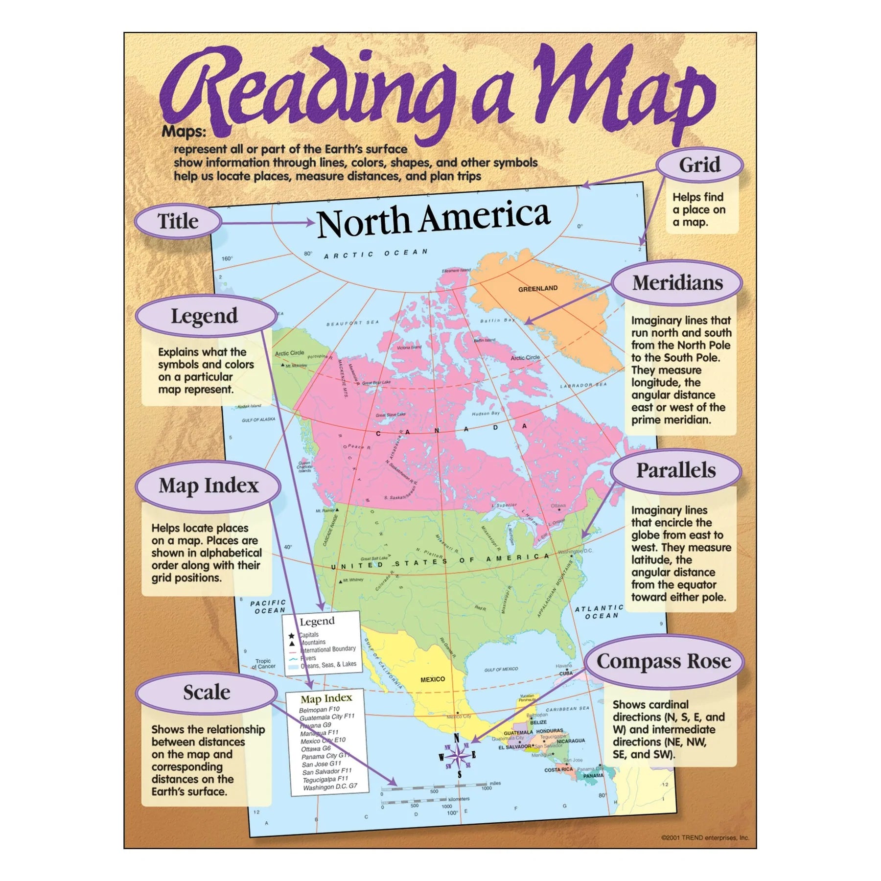
What is a Map?
A map is a picture that shows us places from above Maps help us understand where things are located Maps use special symbols and colors to show different features Every map has tools to help us read it correctly

Find the Rivers!
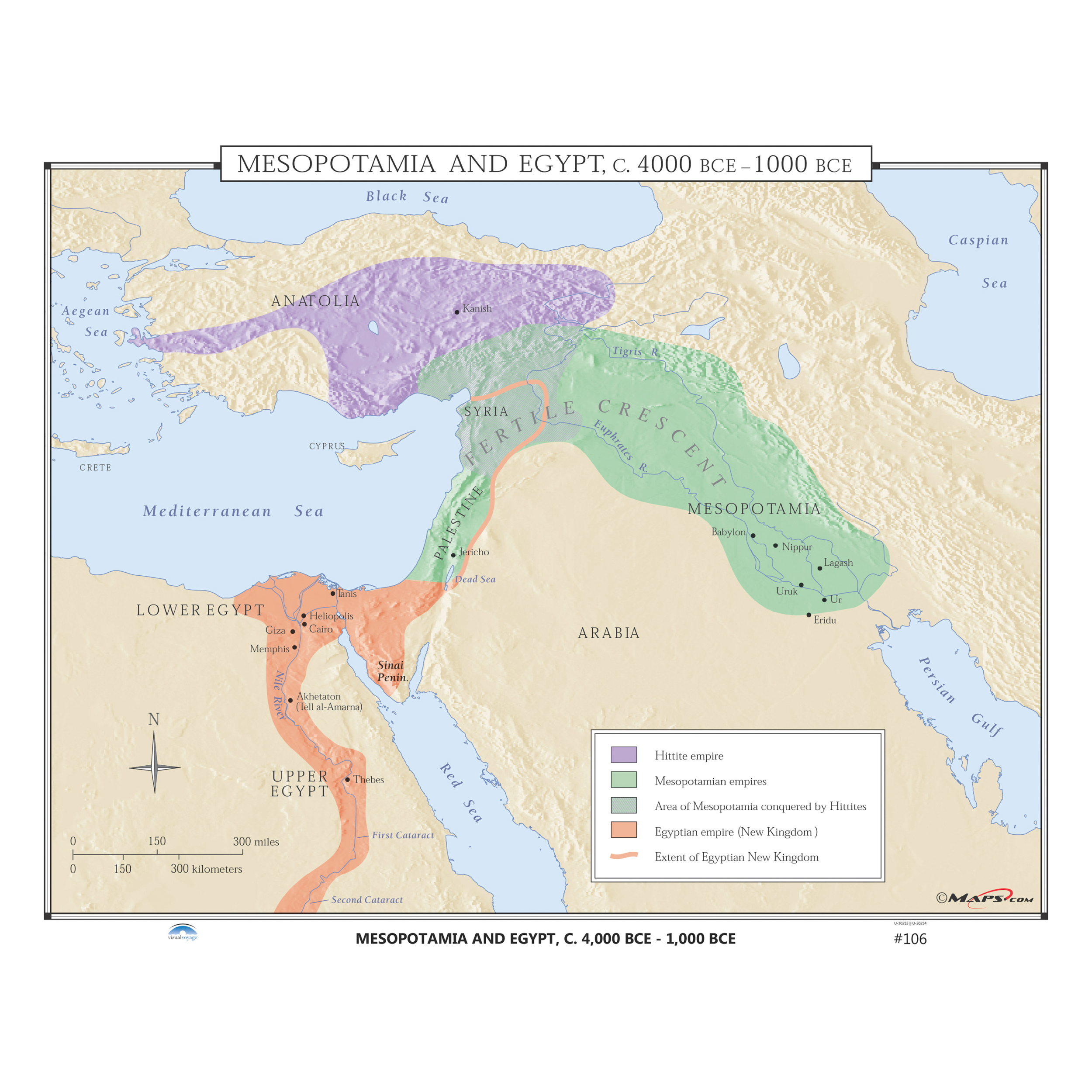
Look at our Mesopotamia map Use your finger to trace the Tigris River from north to south Now trace the Euphrates River Which river is on the east? Which is on the west?
Spatial Thinking Challenge
If you were traveling from the mountains to the sea, which direction would you go? Which ancient city is closest to both rivers? How might people use these rivers in their daily lives?

Map Tools We Use
{"left":"Compass Rose - shows directions (North, South, East, West)\nLegend - explains what symbols mean","right":"Ruler - measures distances between places\nScale - shows how big areas really are"}

Be a Map Detective!
Use your ruler to measure the distance between two cities Find a city that is north of the rivers Locate the mountains - are they in the north or south? Write your answers on your whiteboard!

What We Discovered Today
Maps help us understand where ancient people lived Rivers were very important for ancient civilizations We can use map tools to answer questions about places Ancient Mesopotamia was located between two great rivers