World Hemispheres Ew — free printable diagram
Free geography resource for teachers · CC BY-NC 4.0
About this illustration
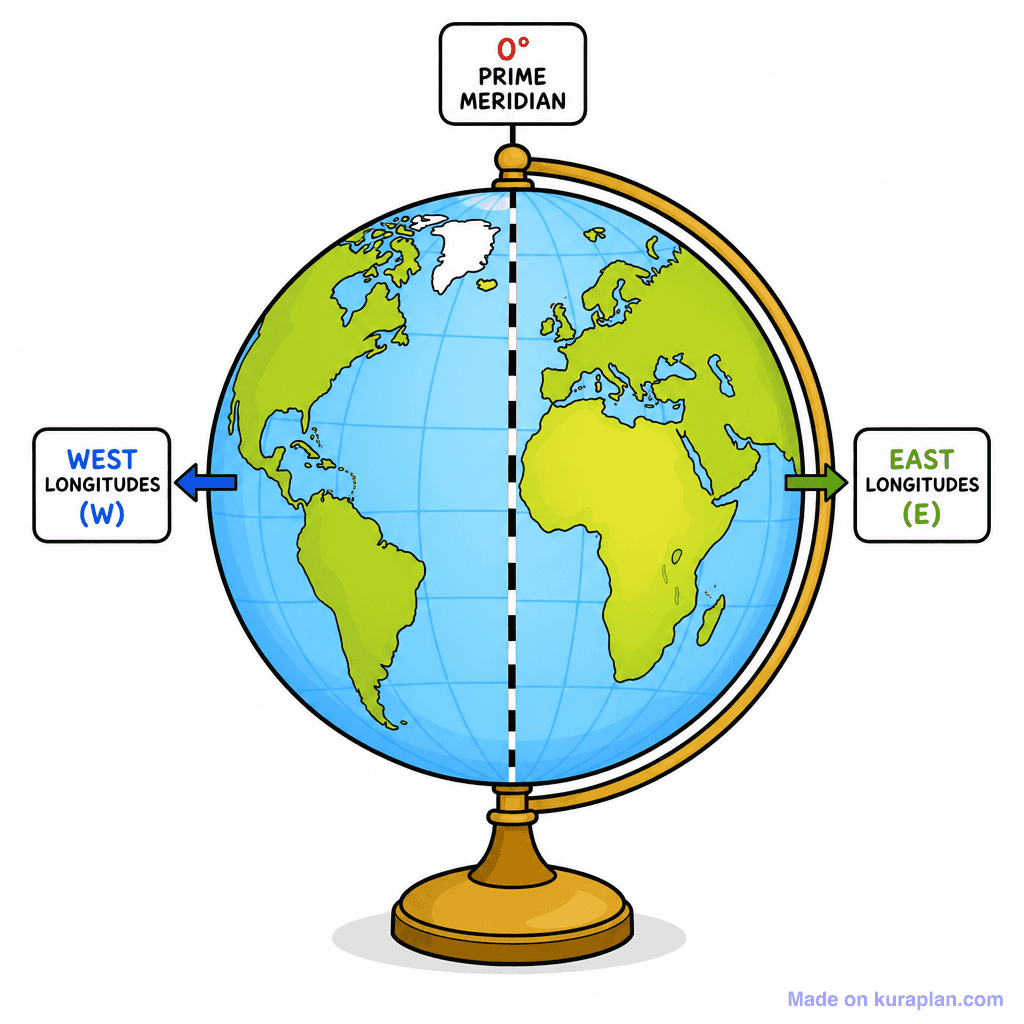
This vibrant illustration depicts a cartoon-style globe on a golden stand, showing the major continents in green against blue oceans. A prominent dashed black line runs vertically through the globe, clearly labeled "0° PRIME MERIDIAN" at the top. To the left, an arrow points west with the label "WEST LONGITUDES (W)", and to the right, an arrow points east with "EAST LONGITUDES (E)". This image teaches the foundational geographic concept of longitude and the Prime Meridian, illustrating how the Earth is divided into eastern and western hemispheres for coordinate systems. It is ideal for an introductory geography lesson slide, a worksheet for identifying directions, or as part of a label exercise on global coordinates. The visual style is a clear, high-contrast flat illustration, perfect for K-6 students.
How to use
- 1Right-click the image and choose “Save image as”, or use the download button.
- 2Use it in your classroom worksheets, slides or printables — free under CC BY-NC 4.0.
- 3Attribute as “Image by Kuraplan” or link back to kuraplan.com. Not for commercial resale.
Make worksheets with images like this
Kuraplan's editor has the full image library built in — drag-and-drop into a worksheet in seconds.
Related illustrations
More from World Maps (Thematic)

Browse by subject
18 subjects · 5,127 free illustrations
Maths
1,900 free illustrations
Cross-Curricular
835 free illustrations
Science
816 free illustrations
English
615 free illustrations
Health
200 free illustrations
social_studies
177 free illustrations
Religious Education
139 free illustrations
Music
129 free illustrations
Art
66 free illustrations
Drama
56 free illustrations
social_sciences
48 free illustrations
History
47 free illustrations
arts
26 free illustrations
pe
25 free illustrations
te_reo_maori
24 free illustrations
tech
16 free illustrations
culture
7 free illustrations
languages
1 free illustrations