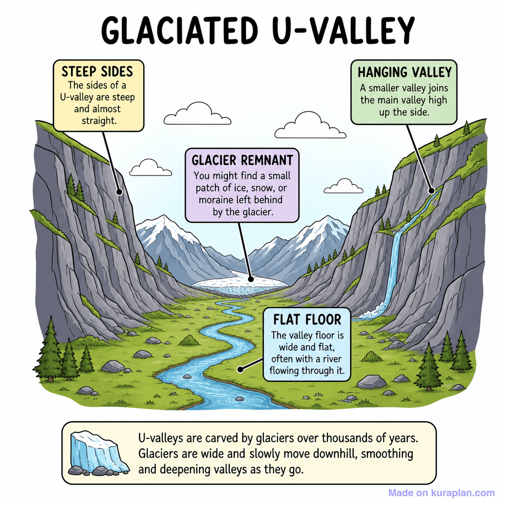
V Shaped Valley Cross Section — free printable diagram
Free geography resource for teachers · CC BY-NC 4.0
About this illustration
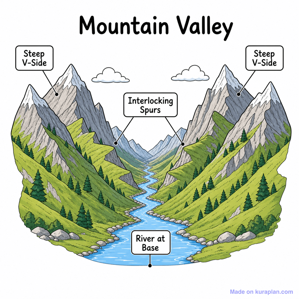
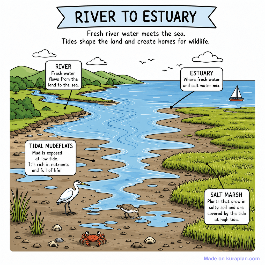
This is a detailed, labelled illustration of a mountain valley, depicting key geographical features. It concretely shows the 'Steep V-Side' of the mountains, the 'Interlocking Spurs' where the ridges meet, and the 'River at Base' winding through the valley floor. This diagram is designed to teach students about landforms and physical geography concepts, particularly focusing on the characteristics of river-carved valleys. It is suitable for classroom activities such as worksheets, educational slides, or label exercises, and features a clear, flat illustration style with defined outlines, ideal for K-12 education.
How to use
- 1Right-click the image and choose “Save image as”, or use the download button.
- 2Use it in your classroom worksheets, slides or printables — free under CC BY-NC 4.0.
- 3Attribute as “Image by Kuraplan” or link back to kuraplan.com. Not for commercial resale.
Make worksheets with images like this
Kuraplan's editor has the full image library built in — drag-and-drop into a worksheet in seconds.
Related illustrations
More from Rivers & Water Features
Browse by subject
18 subjects · 5,159 free illustrations

Maths
1,912 free illustrations
Cross-Curricular
839 free illustrations

Science
818 free illustrations

English
625 free illustrations

Health
201 free illustrations
social_studies
178 free illustrations

Religious Education
140 free illustrations
Music
130 free illustrations

Art
66 free illustrations

Drama
56 free illustrations

social_sciences
48 free illustrations

History
47 free illustrations

arts
26 free illustrations

pe
25 free illustrations

te_reo_maori
24 free illustrations

tech
16 free illustrations

culture
7 free illustrations

languages
1 free illustrations