Polynesian Voyaging Routes Across the Pacific (detailed) — free printable clipart
Free social_sciences resource for teachers · CC BY-NC 4.0
About this illustration
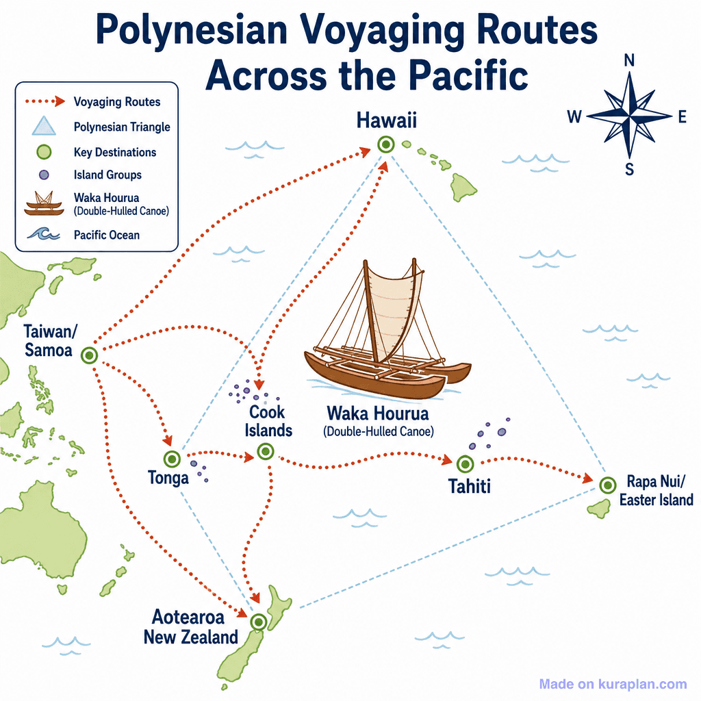
A coloured map showing Polynesian voyaging routes across the Pacific Ocean. Red dotted arrows indicate voyaging routes connecting key island destinations: Hawaii (north), Tahiti (east-centre), Rapa Nui/Easter Island (far east), Cook Islands (centre), Tonga (west-centre), Aotearoa New Zealand (south-west), and Taiwan/Samoa (west). A dashed blue triangle outlines the Polynesian Triangle. A illustrated Waka Hourua (double-hulled canoe) is depicted in the centre of the map. A legend and compass rose are included.
How to use
- 1Right-click the image and choose “Save image as”, or use the download button.
- 2Use it in your classroom worksheets, slides or printables — free under CC BY-NC 4.0.
- 3Attribute as “Image by Kuraplan” or link back to kuraplan.com. Not for commercial resale.
Make worksheets with images like this
Kuraplan's editor has the full image library built in — drag-and-drop into a worksheet in seconds.
Browse by subject
18 subjects · 5,619 free illustrations
Maths
1,895 free illustrations
Cross-Curricular
835 free illustrations
Science
816 free illustrations
English
612 free illustrations
Geography
549 free illustrations
Health
200 free illustrations
social_studies
177 free illustrations
Religious Education
139 free illustrations
Music
128 free illustrations
Art
66 free illustrations
Drama
56 free illustrations
History
47 free illustrations
arts
26 free illustrations
pe
25 free illustrations
te_reo_maori
24 free illustrations
tech
16 free illustrations
culture
7 free illustrations
languages
1 free illustrations