Polynesian Voyaging Routes Across the Pacific (simple) — free printable clipart
Free social_sciences resource for teachers · CC BY-NC 4.0
About this illustration
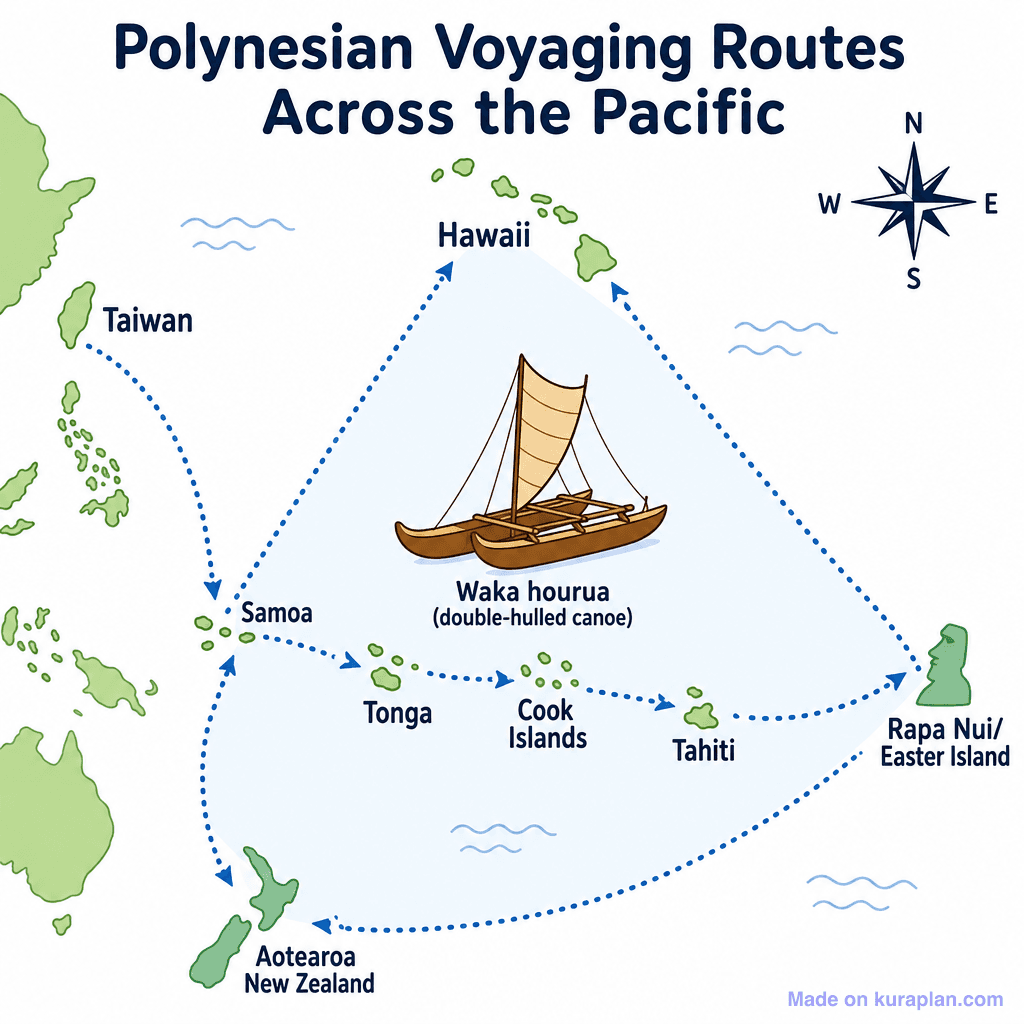
A simplified map of the Pacific Ocean showing Polynesian voyaging routes as dotted arrows connecting key island groups and locations. The Polynesian Triangle is shaded in light blue, with vertices at Hawaii (north), Rapa Nui/Easter Island (east), and Aotearoa New Zealand (south-west). Additional stops along the routes include Samoa, Tonga, Cook Islands, and Tahiti. Taiwan is labelled to the west as a migration origin point. A central illustration of a waka hourua (double-hulled canoe) is featured with a label. A compass rose is shown in the top-right corner.
How to use
- 1Right-click the image and choose “Save image as”, or use the download button.
- 2Use it in your classroom worksheets, slides or printables — free under CC BY-NC 4.0.
- 3Attribute as “Image by Kuraplan” or link back to kuraplan.com. Not for commercial resale.
Make worksheets with images like this
Kuraplan's editor has the full image library built in — drag-and-drop into a worksheet in seconds.
Browse by subject
18 subjects · 5,664 free illustrations

Maths
1,912 free illustrations

Cross-Curricular
839 free illustrations

Science
818 free illustrations

English
625 free illustrations
Geography
553 free illustrations

Health
201 free illustrations
social_studies
178 free illustrations

Religious Education
140 free illustrations
Music
130 free illustrations

Art
66 free illustrations

Drama
56 free illustrations

History
47 free illustrations

arts
26 free illustrations

pe
25 free illustrations

te_reo_maori
24 free illustrations

tech
16 free illustrations

culture
7 free illustrations

languages
1 free illustrations