Monsoon Map India — free printable diagram
Free geography resource for teachers · CC BY-NC 4.0
About this illustration
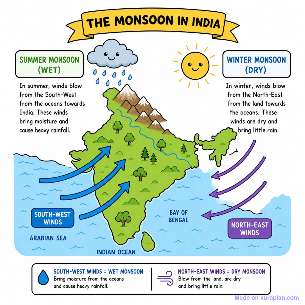
This educational diagram visually explains the monsoon in India, depicting a map of India with surrounding oceans. It shows two distinct wind patterns: blue arrows illustrating the Summer Monsoon (wet) with south-west winds bringing moisture from the oceans, and purple arrows representing the Winter Monsoon (dry) with north-east winds blowing dry air from land to sea. The diagram includes explanatory text boxes for each monsoon type and wind direction, a smiling rain cloud for wet conditions, and a smiling sun for dry conditions. This flat illustration is ideal for slides, worksheets, or label exercises in geography lessons concerning climate and weather patterns in India.
How to use
- 1Right-click the image and choose “Save image as”, or use the download button.
- 2Use it in your classroom worksheets, slides or printables — free under CC BY-NC 4.0.
- 3Attribute as “Image by Kuraplan” or link back to kuraplan.com. Not for commercial resale.
Make worksheets with images like this
Kuraplan's editor has the full image library built in — drag-and-drop into a worksheet in seconds.
Related illustrations
More from Weather & Climate


Browse by subject
18 subjects · 5,160 free illustrations

Maths
1,912 free illustrations

Cross-Curricular
839 free illustrations

Science
818 free illustrations

English
626 free illustrations

Health
201 free illustrations

social_studies
178 free illustrations

Religious Education
140 free illustrations
Music
130 free illustrations

Art
66 free illustrations

Drama
56 free illustrations
social_sciences
48 free illustrations

History
47 free illustrations

arts
26 free illustrations

pe
25 free illustrations

te_reo_maori
24 free illustrations

tech
16 free illustrations

culture
7 free illustrations

languages
1 free illustrations