Karst Landscape — free printable diagram
Free geography resource for teachers · CC BY-NC 4.0
About this illustration
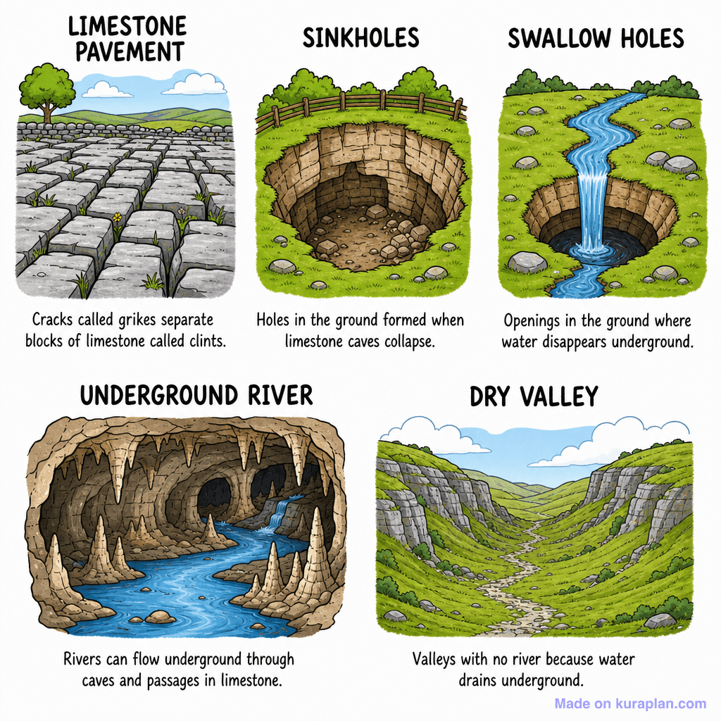
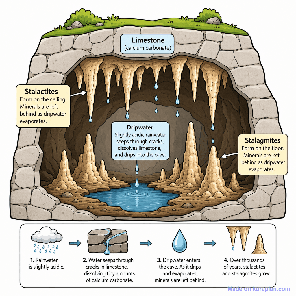
This image is a cartoon-style diagram illustrating five different karst landforms, each with a descriptive title and a short explanation. It visually depicts a Limestone Pavement with grikes and clints, Sinkholes with collapsed ground, Swallow Holes where water disappears underground, an Underground River flowing through a cave with stalagmites and stalactites, and a Dry Valley without a river. This resource teaches key concepts in physical geography and geology related to limestone erosion and hydrogeology. It is ideal for classroom slides, worksheets, or as a visual aid for teaching about geological features, suitable for a KS2 or KS3 Earth Science curriculum.
How to use
- 1Right-click the image and choose “Save image as”, or use the download button.
- 2Use it in your classroom worksheets, slides or printables — free under CC BY-NC 4.0.
- 3Attribute as “Image by Kuraplan” or link back to kuraplan.com. Not for commercial resale.
Make worksheets with images like this
Kuraplan's editor has the full image library built in — drag-and-drop into a worksheet in seconds.
Related illustrations
More from Deserts, Glaciers, Caves
Browse by subject
18 subjects · 5,159 free illustrations

Maths
1,912 free illustrations
Cross-Curricular
839 free illustrations

Science
818 free illustrations

English
625 free illustrations

Health
201 free illustrations
social_studies
178 free illustrations

Religious Education
140 free illustrations
Music
130 free illustrations

Art
66 free illustrations

Drama
56 free illustrations

social_sciences
48 free illustrations

History
47 free illustrations

arts
26 free illustrations

pe
25 free illustrations

te_reo_maori
24 free illustrations

tech
16 free illustrations

culture
7 free illustrations

languages
1 free illustrations