Layers of the Earth (detailed) — free printable diagram
Free science resource for teachers · CC BY-NC 4.0
About this illustration
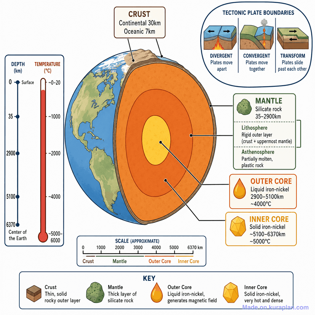
A detailed, labeled cross-section diagram of Earth's interior layers showing the crust, mantle, outer core, and inner core. Includes a depth/temperature scale on the left, a tectonic plate boundaries inset (top right), a scale bar, and a key at the bottom. Additional sub-labels identify the lithosphere and asthenosphere within the mantle region. Depth markers: surface 0 km, crust base ~35 km, mantle base 2900 km, outer core base 5100 km, inner core/centre 6370 km. Temperature ranges from ~0–20°C at surface to ~5000–6000°C at centre.
How to use
- 1Right-click the image and choose “Save image as”, or use the download button.
- 2Use it in your classroom worksheets, slides or printables — free under CC BY-NC 4.0.
- 3Attribute as “Image by Kuraplan” or link back to kuraplan.com. Not for commercial resale.
Make worksheets with images like this
Kuraplan's editor has the full image library built in — drag-and-drop into a worksheet in seconds.
Browse by subject
18 subjects · 4,851 free illustrations
Maths
1,895 free illustrations
Cross-Curricular
835 free illustrations
English
612 free illustrations
Geography
549 free illustrations
Health
200 free illustrations
social_studies
177 free illustrations
Religious Education
139 free illustrations
Music
128 free illustrations
Art
66 free illustrations
Drama
56 free illustrations
social_sciences
48 free illustrations
History
47 free illustrations
arts
26 free illustrations
pe
25 free illustrations
te_reo_maori
24 free illustrations
tech
16 free illustrations
culture
7 free illustrations
languages
1 free illustrations